Chimborazo (6,263 m)

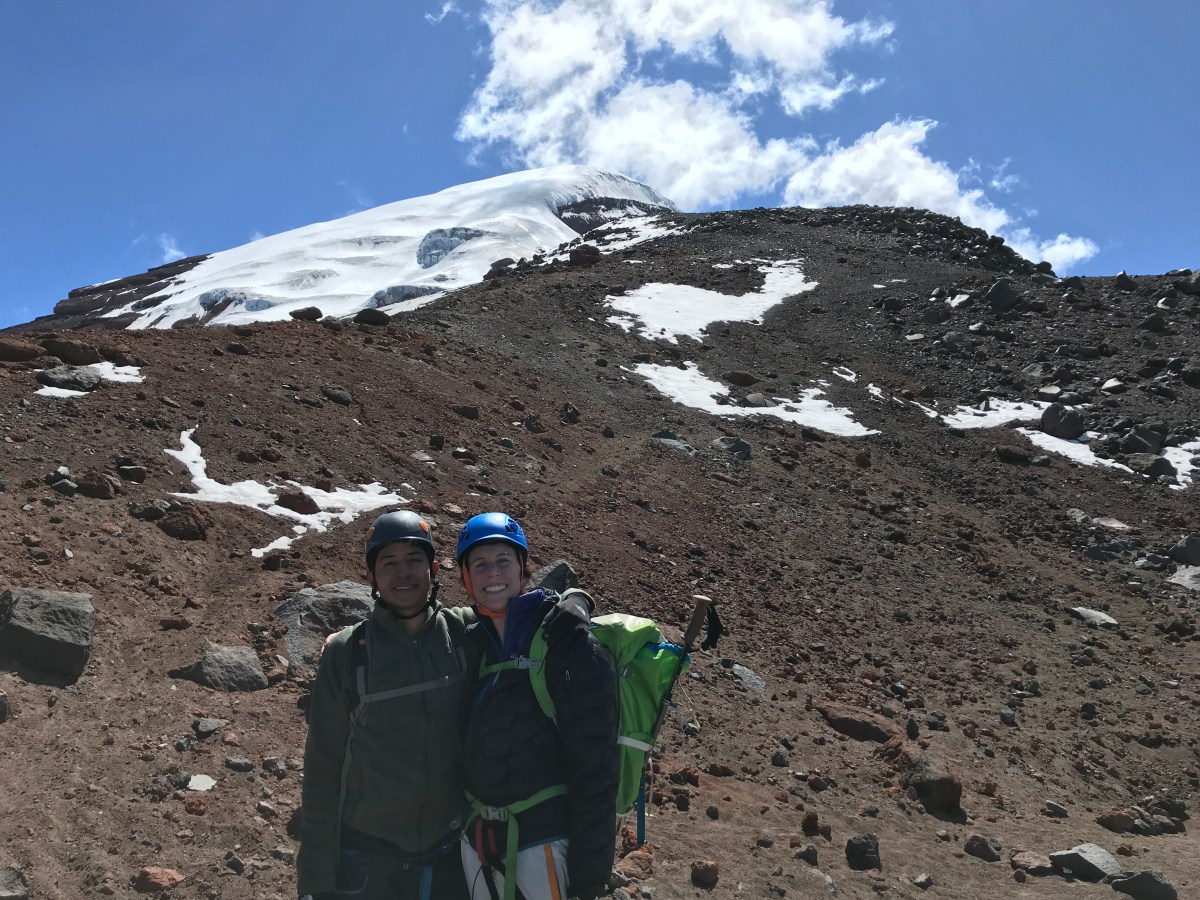
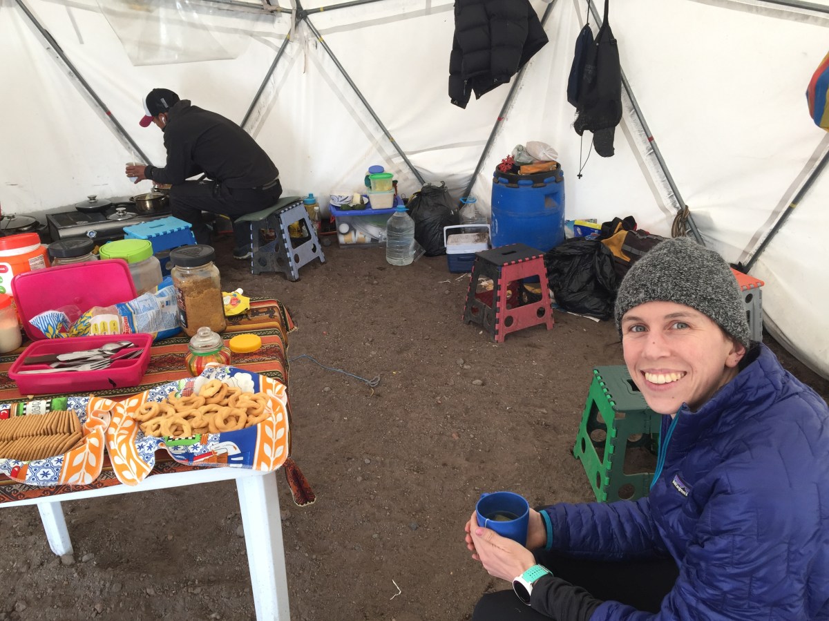
Sleeping at high altitude is difficult and can certainly be a challenge for mountaineers. I felt strong when we finally arrived at the high camp of Chimborazo at around 5,300 meters above sea level or about 17,388 ft. While dinner was being prepared by the person in charge of the high camp and his 12-year-old son, Brittany and I were getting our equipment ready for the summit attempt. After dinner, we tried (as always) to get some sleep but at this altitude, it’s almost impossible to get proper rest. The constant headache didn’t go away, which is normal, but after a few hours in the tent, I started to feel nauseous. A common sign of altitude sickness. For the first time, I felt this way and I tried to concentrate so that it could pass. I told Brittany that I was not well and needed to get out of the tent. Just when I was getting out I almost puked and I knew that Chimborazo was going to be harder than any mountain that I have ever climbed.

I’m writing this post as Ecuador and the world is going through quarantine as we all try to prevent COVID-19 from spreading in our communities. I can only hope that the world recovers soon so that we can all go back to our normal lives and to the mountains. 

IMG_9216
Brittany and I with Chimborazo in the background

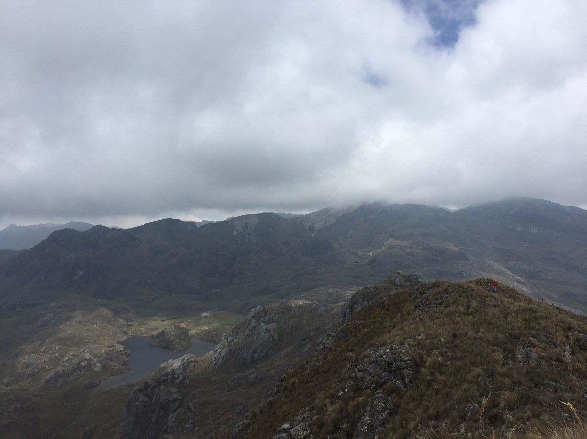
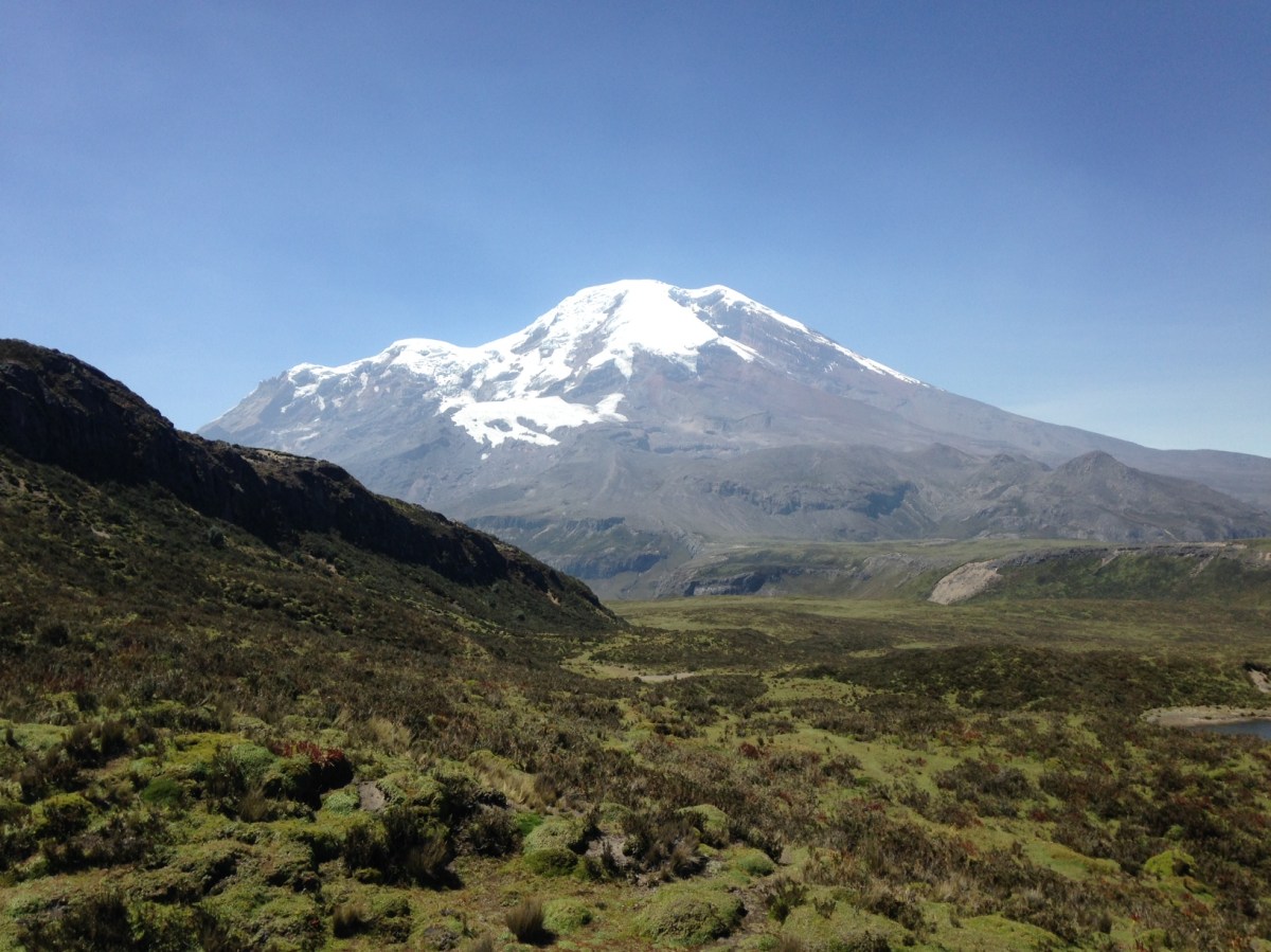
At 6,263 m (20,549 ft) , Chimborazo is Ecuador’s highest mountain and the closest place to the sun when measured from the center of the earth. It’s the only mountain in this country that is over 6,000 meters or 20,000 ft. It’s been a dream for many years and the chance to climb it finally arrived. 

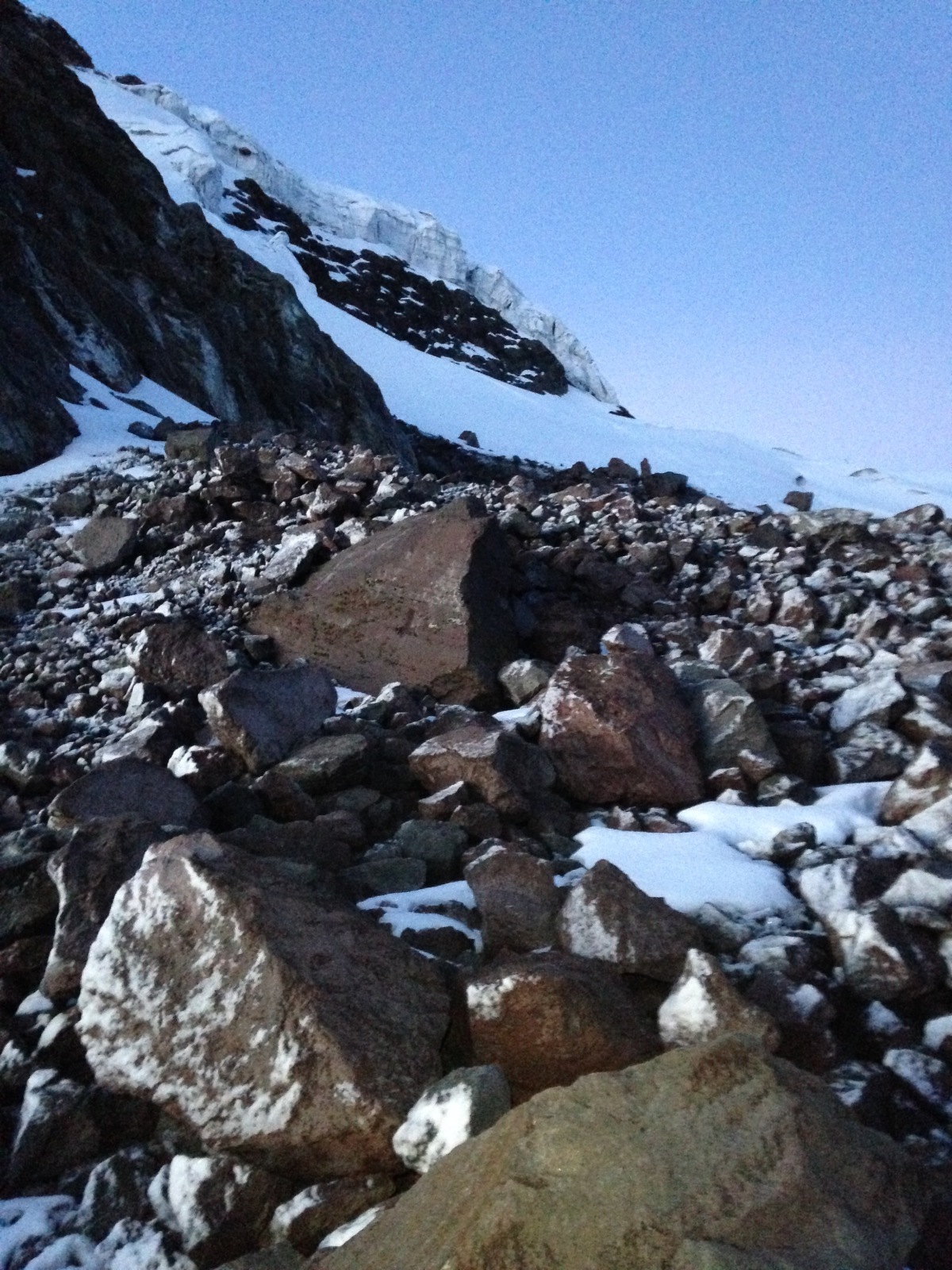
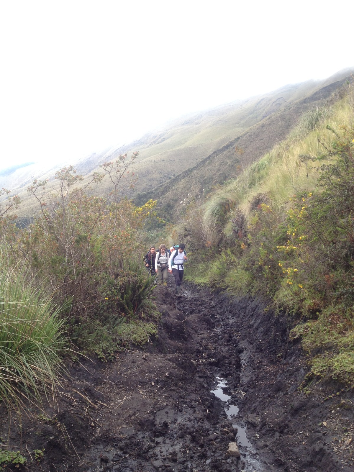
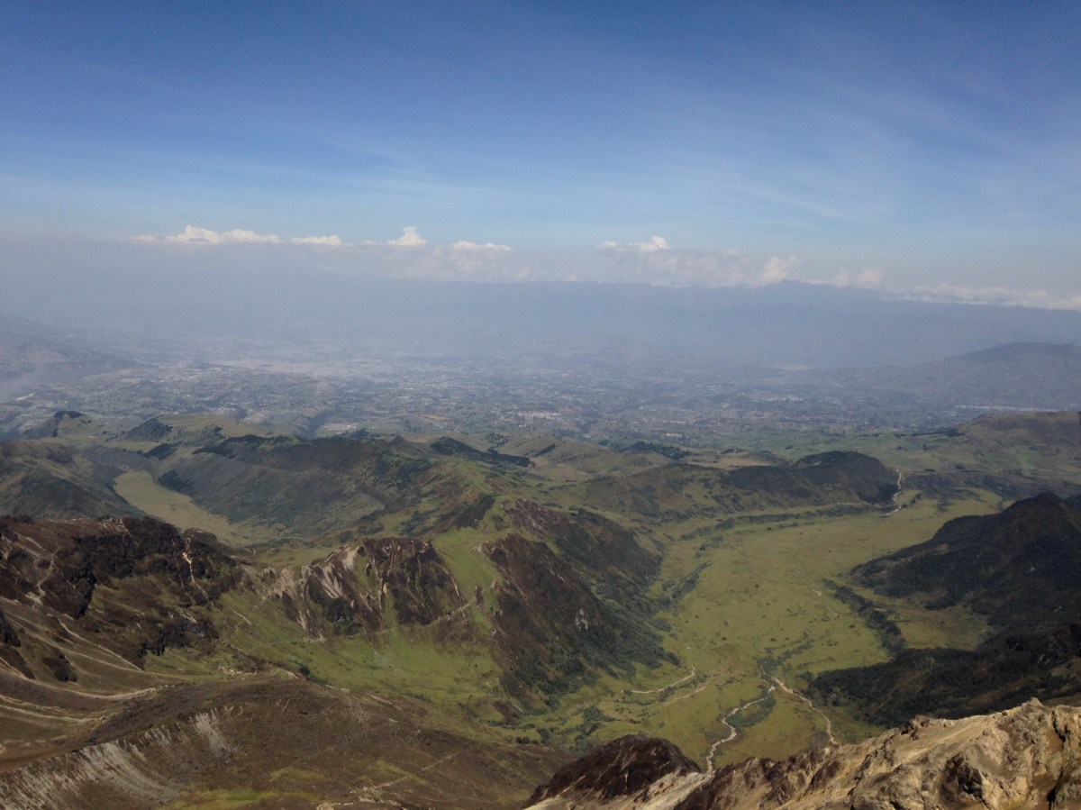
For this climb, Brittany and I went with Pedro (Pepo’s brother, with whom we climbed Cotopaxi). Chimborazo is located about 3.5 hours south of Quito so we left on Saturday, February 15th early in the morning. There are different options to choose from when attempting this climb, one of them is to start at Refugio Carrel (4,850m) or Refugio Whymper (5,050m). We decided to start from the relatively new high camp at about 5,300m. 

IMG_2380
High camp at 5,300m
IMG_2388
Snack time!

The nausea didn’t go away for a while but I knew that I had to try. I was breathing deeply and concentrating. I’d been waiting for this moment for many years and training for 5 weeks and I was not going to give up easily. Years ago, the glacier would have been right where our high camp was but global warming has decreased the glacier of Chimborazo at an alarming rate. We started the hike at 12:20am and it wasn’t until about 2 hours later that we put on our crampons! 

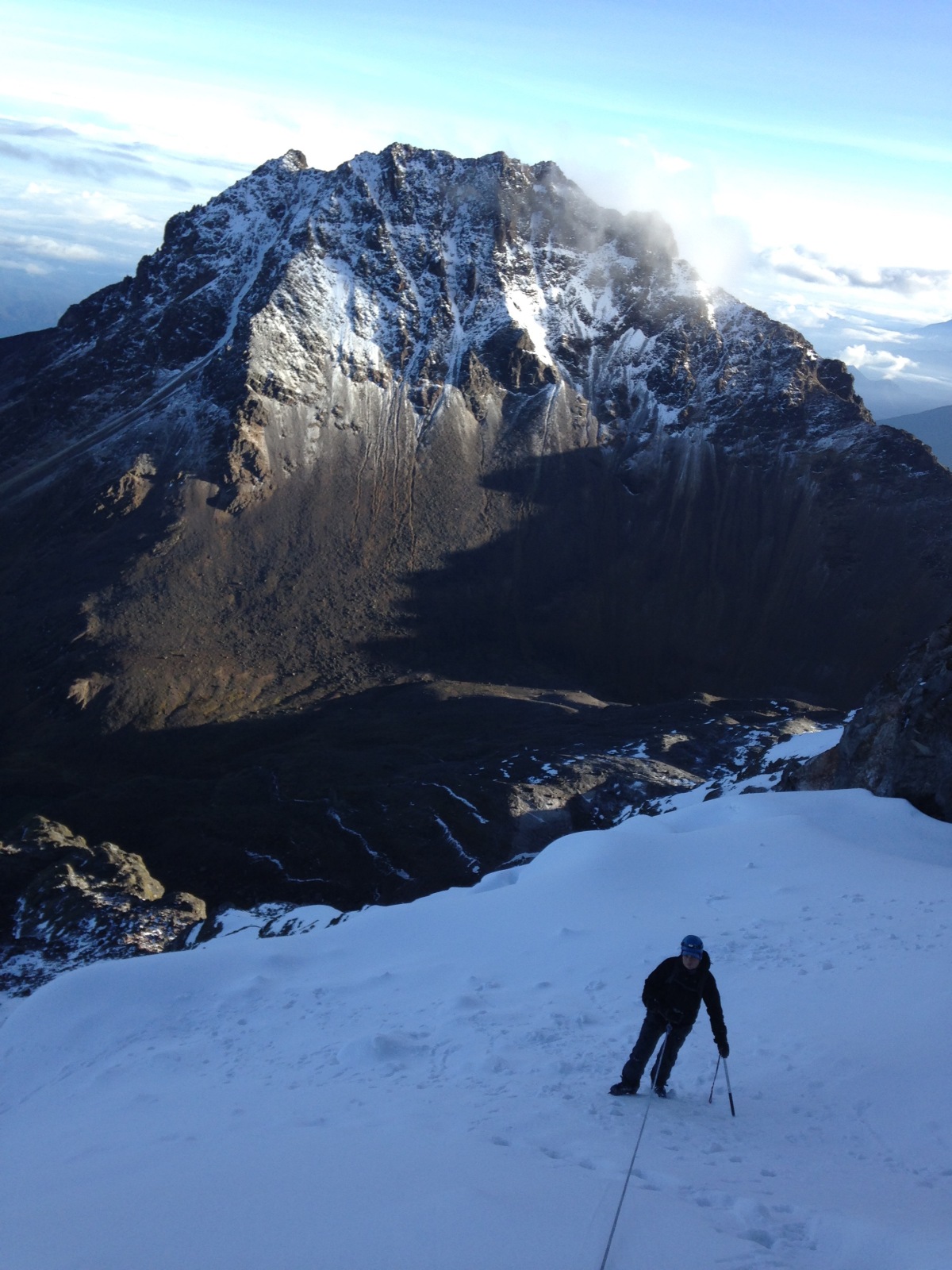
The first section of El Castillo, which started a few minutes after we left high camp, is quite dangerous as there are loose rocks. Brittany struggled here so Pedro decided to rope up with her. This first section of the glacier was particularly challenging as it was a mixture of black ice with rocks so we had to be careful in every step. Many people who had climbed Chimborazo told me not to look up as there are many ramps along the way that appear to be false summits. I couldn’t help but look up only to see the next ramp and knowing that we were closer and closer. 

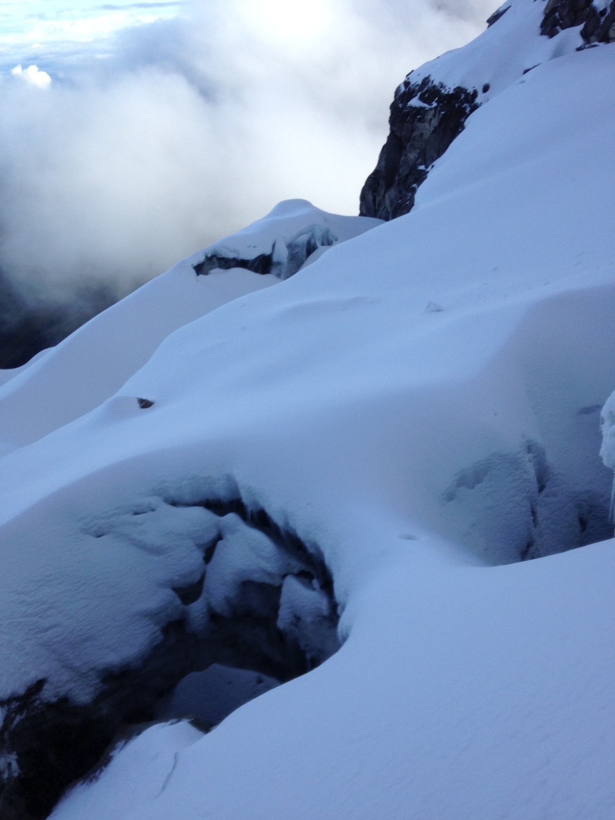
Four plus hours passed and in between very short breaks with some water and Manicho chocolate bars. Although it was hard to take breaks as there was no flat ground. I was focusing on my breathing and taking it two steps at a time. Deep breath, two steps, deep breath, two steps. I kept thinking to myself that the pain is temporary, but the achievement will be forever. Deep breath, two steps, deep breath, two steps.  I peeked at the altitude on my phone and we were at about 5,900m or the height of Cotopaxi and that was a relief. Half an hour later and we’ve reached the 6000m mark, the highest I’ve been in my life. I was exhausted but the weather was in our favor. I knew we were going to summit on this day. 

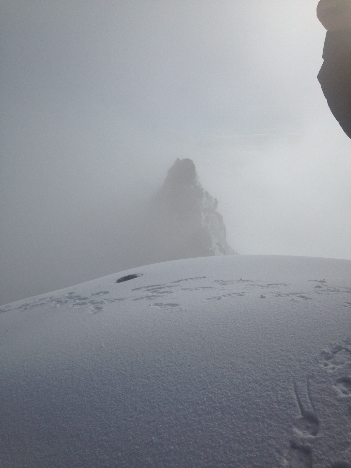
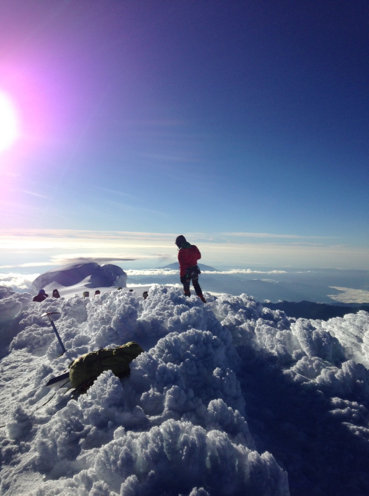
“How long until we reach the first summit?” I asked Pedro. “We are about half an hour away,” he replies. These were the longest 30 minutes of my life. There was another “cordada” or group of climbers roped up together who were hiking at our pace for most of the climb. Sunrise was just starting when we were finally reaching the first summit of Chimborazo, Veintimilla summit at 6,230m. Most climbers end up here and turn back, mainly due to exhaustion or bad weather conditions. I couldn’t help to look at the other group member who started puking as soon as he reached this first summit. No celebration for us yet, as our goal was to reach the main summit. 

IMG_2408
Veintimilla Summit

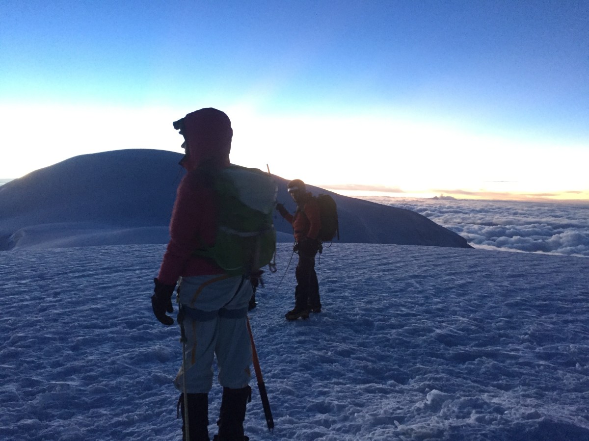
I could see it from where we were standing, it looked so close yet so far away. These 30 plus meters seem to be eternal as the altitude combined with tiredness makes this part quite difficult. Then it hit me, I was minutes away from achieving a long time dream and I started bursting into tears of happiness and joy. “How lucky I am to experience this,” I thought. Many things are going through my mind at this point; all the hard work, the training days in Pichincha, and my family who always support me in climbing mountains. I could see the other groups celebrating, I was so close. I looked back and I could see the other cordada coming towards us. 

IMG_2435
The closest place to the sun from the center of the earth

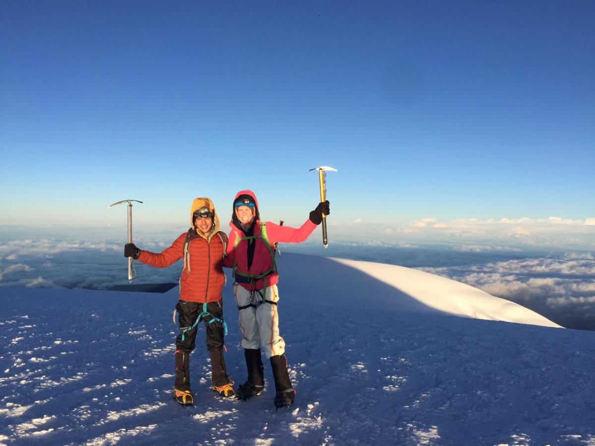
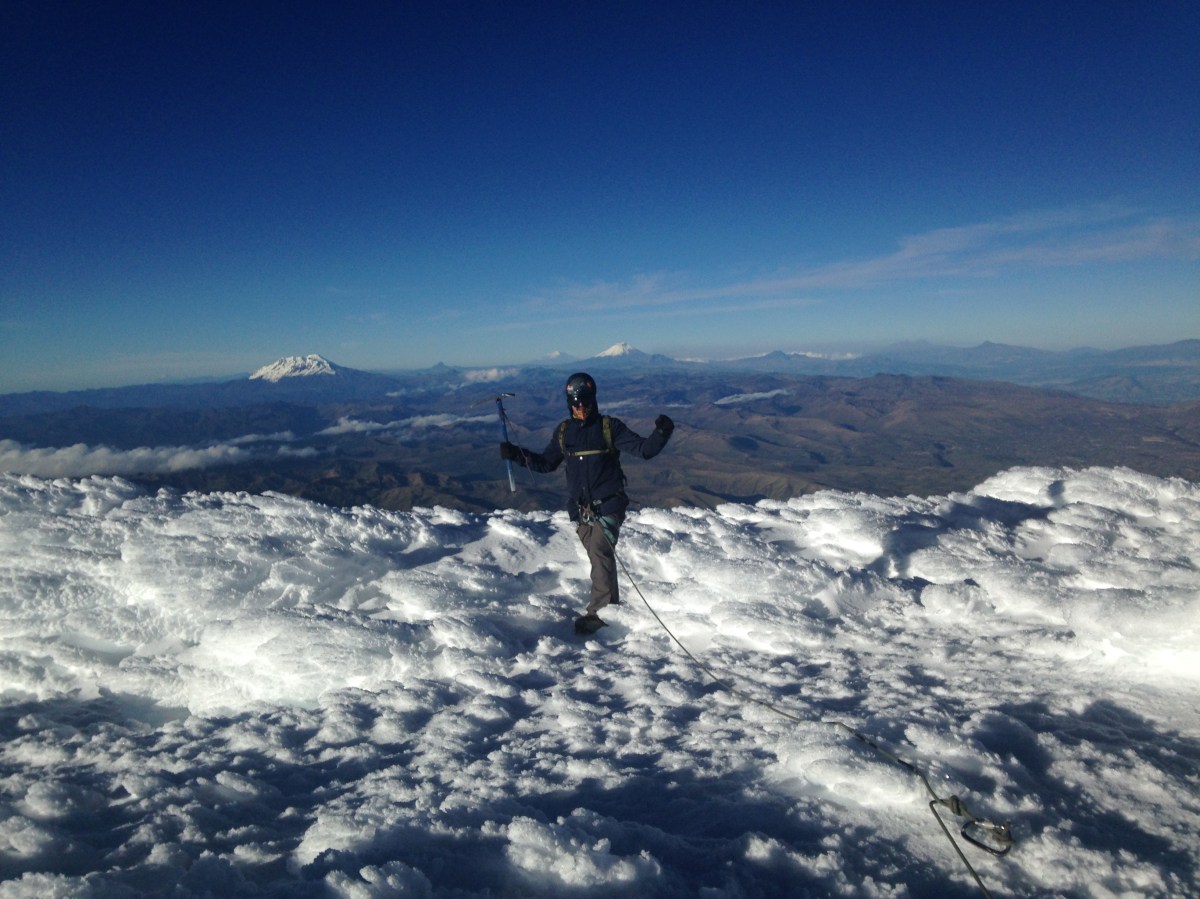
On February 16th, 2020 at 6:14am, I was standing at the highest point in Ecuador, Whymper summit of Chimborazo at 6,263 m (20,549 ft). I high fived Pedro and gave Brittany a big hug. It was emotional. We did this together. All the hard work paid off. What a moment. It’s hard to describe in words how you feel in moments like this. You just have to experience it yourself. All the pain and suffering goes away when you have the joy and pleasure to see this. I could see the clouds below us, the sun closer to us than ever before. Gracias Taita Chimborazo! 

81e6b288-0c43-4b97-8fb9-449c39476806
Whymper summit of Chimborazo at 6,263 m (20,549 ft)

Tungurahua Volcano

Just 2 years ago, Tungurahua was in volcanic activity and erupted. The idea of climbing it was out of the question back then but today its accessible to visitors and climbers. Its name comes from the Quechua language and it means “Throat of Fire”. As Ecuador’s ninth highest peak at 5,023m, the climb is usually done in 2 days but my friends and I decided to give it a shot in 1 day.

The climb begins by Pondoa, just before reaching Baños (about 2.5 hours from Quito). Be well prepared to carry the essentials for bad weather (waterproof jacket and pants, gaiters, hiking boots, headlamp, plenty of water, etc.). The climb begins with a humid and muddy terrain that is steep and it took us about 2 hours to reach the refugio. Most people sleep over at the refugio and continue the climb the next day.

IMG_7099
The start of the hike with muddy and humid terrain

This refugio is pretty much abandoned and does not have the facilities like the Cotopaxi refugio. Although there was drinkable water there and it helped a lot. After a 15 minute break, we continued the actual climb to the top. Its very steep and sandy (we call it arenal) with lots of loose rocks. It seemed endless but you have to take it slowly, step by step. Sara and Brittany took the lead with other people and Hernan and I stayed behind at our own pace. After a while, it became impossible to see them with all the fog.

IMG_7114
Beginning of the steep part after the refugio

For moments I felt that I was too tired to continue but we took short breaks for snacks and water to get some more fuel and kept going. As mentioned before, there are lots of loose rocks so it’s important to wear a helmet in the “arenal” section. This is a serious climb, especially if you do it in one day. It’s a climb that gets very mental as you have to motivate yourself and others to continue.

IMG_7129
Clearing up a bit with Baños in the background

As Hernan and I were reaching the top, we saw some people coming down and Brittany and Sara were super relieved to see us. They turned back with us to see the crater but it was foggy so we couldn’t really see it. We took some photos and we started to descend. I was super tired but happy to reach the crater (we couldn’t continue to the summit (about 30 more mins) as it was getting late.

IMG_7138
At the crater with Brittany, me, Hernan and Sara

After a few minutes of descending, it started clearing up completely and I told Hernan that we had to go back to see the crater. The girls continue descending. When we reached the crater it’s when I knew that all the pain and suffering of the climb had been worth it. I climb mountains not only because I’m passionate about them, but because it makes me feel more alive. Seeing that crater was a beautiful moment that I will always remember. If it was easy to climb with mountain, more people will do it. But it definitely pushed me to my limits, almost as much as my first big climb of Cayambe.

IMG_7173
The crater all cleared up

The descent was brutal, especially for the knees. The climb down after the refugio was the most painful and challenging one for me, as my legs were burned out and we had to climb in the dark with headlamps. Another volcano, another goal. 10.5 hours of climbing in one day. The pain was worth it but I don’t think I’ll climb Tungurahua in the near future. Maybe next time it’s better to climb it in 2 days and make it to the main summit.

Cajas National Park

As one of Ecuador’s greatest National parks, Cajas is a must when visiting the city of Cuenca. Just about an hour away from the city’s bus terminal, this park has everything you wished for in the paramo, from high altitude summits to foxes hanging out outside of the refugio.

For $2 you can take a bus going towards Guayaquil. Buses usually leave every other hour from the bus terminal and will drop you off right next to the main refugio of the park, which is surrounded by the beautiful “Laguna Toreadora”.

IMG_4041
Laguna Toreadora

Britt and I arrived there during carnival weekend with the plan of camping at the park. Surprisingly the refugio was almost empty and we were recommended by the park ranger to sleep there at night with no extra cost. Park entrance fee is only $2 for Ecuadorean nationals and $4 for foreigners.

We took the advice of the park ranger and left our things at the refugio. In the afternoon we had some time to walk around Laguna Toreador, an easy and straightforward trek. At night, while having dinner at the refugio porch, a paramo Fox appeared close by. The first I’ve seen one of these guys in almost 2 years of hiking mountains in the paramo!

IMG_4268
Routes are well marked throughout the park


There are many trekking routes with different difficulty levels throughout the park and the next morning we decided to do route 1. After an hour or so, we saw some waterfalls that were part of a different route so we did a little change of plans as our main goal was to climb Cerro San Luis at 4,252 m.

IMG_4101
Waterfall views

Cerro San Luis is an awesome hike with some steep parts and loose rocks. As you climb this Cerro, it seems like you’ve reached the summit only to find that there is still some climbing to do. This happened like 3 times until we finally reached the main summit. It’s definitely worth it, as you have beautiful views of the surrounding lakes and mountains. Make sure to try the truchas at the park’s restaurant next to the refugio!

IMG_4138
Cerro San Luis summit at 4,252 m

Cajas is a massive park that will surely take more than two days to explore.

Cuenca

It’s been 24 years since I last visited the city of Cuenca, when my father was stationed there in the Ecuadorean military. As a 4-year-old, I don’t recall the majority of my time in Cuenca so when I went back for the long carnival weekend, it was like going for the first time. It’s Ecuador’s third largest city and it’s noted for having a historic center listed as a UNESCO World Heritage Trust site with beautiful and well conserved old buildings.

IMG_3987
One of the city’s well conserved buildings

Luckily through my dad, my travel buddy (Britt) and I, received free accommodation just a 15-minute walk from Cuenca’s historic center! We started our first day with a nice little breakfast in a place called Windhorse Cafe. Try the Guatemala Sunrise for a cheap but great morning start! Just across the street from this place is the well-known “Tomebamba River”. Carnival in Ecuador means throwing lots of water and foam to strangers and kids from the nearby school were having an awesome last day of classes splashing water on this river.

IMG_3912
Kids playing carnival in Tomebamba River

After that, we headed to Pumapungo museum, where you can learn some native Ecuadorean history and find some interesting arqueological artifacts. It’s a big museum that has it all, from modern art of local artists to an outside garden that includes a bird centre! The best part? It’s a free admission museum! One of the things that I liked the most about this city, are the murals that you find while walking around downtown. They are well made by artists and sponsored by the city government!

IMG_3936
Cool downtown mural

The usual spot that you can’t miss if you visit Cuenca, is the new cathedral. Make sure to pay the $2 that cost to go all the way up as you will have views of the city that are well worth it! And wrap up your day with the traditional “mote pillo” at Raymipamba restaurant, located in the main square! Cuenca is known for being the most beautiful city in Ecuador and I can see why it has that perception. It might be small but there is plenty to do, I’ll be back to try your famous “cuy” Cuenca!

IMG_3954
View from the New Cathedral
IMG_3989
Mote Pillo

Next Stop: Cajas National Park

Cotopaxi (5,897 m)

At 5,897 m (19, 347 ft), Cotopaxi is one of the highest active volcanoes in the world and Ecuador’s second highest peak. Due to volcanic activity, access to it’s summit was closed for over 2 years. Last month, conditions of the volcano went back to normal and its summit was re-opened for climbers.

Since I started climbing mountains a year and a half ago, Cotopaxi was always present in my mind. Being the most iconic peak in Ecuador, I was happy to be able to finally climb it.

Cotopaxi National Park is one the country’s main attractions, surrounded by beautiful Andes scenery of paramo, lakes and volcanoes. It’s located about an hour away from Quito and also the location of “Jose F. Ribas” refuge where most climbers spend the night before attempting the climb.

IMG_0236
José F. Ribas Refuge

A night at the refuge with dinner and breakfast included is $32. Bring your own sleeping bag and you’re all set. Mountaineering regulations in Ecuador require that all people must climb with a certified guide as well with a permit done through a tourism agency. The refuge was packed with climbers from all over the world. Cotopaxi is Ecuador’s most popular peak to climb.

After a solid “locro de papa” (potato soup) I tried to get some sleep with little success. Before a big climb, many things go through my head and it’s a bit hard to get proper rest. I was woken up at 11:15pm and it was time to get ready. My partners for this climb (Hernan and Jorge) were the same as my previous big climb of Illiniza Sur.

IMG_0206
Locro de Papa “4,864 msnm”

The night was young and calm and the climb begins with a hike up through sand and rocks. Crampons were not necessarily just yet. I looked up and could see a canal of lights, head torches of the climbers who started their summit push before us. I looked down and same story. As we were finally reaching the glacier, we saw to our left what looked like fireworks, a beautiful scenery of thunderstorms in a far distance. My body wasn’t warm yet and I felt a bit tired.

IMG_0212
Climbers getting ready in the dark

Putting on your crampons can take some time if you’re not use to it. So we took advantage of this and went ahead of most groups. One step up, one deep breath. There is plenty of time to think while at the mountain, it keeps your mind busy while putting yourself to the limit. Cotopaxi is an active volcano to the point of almost erupting not too long ago and as we were getting closer to the summit, we passed through a couple of crevasses that produced a smell of sulfur. I began to feel nauseous for moments but luckily there were strong winds that made the odor go away.

IMG_0245
Fellow climbers taking a break

We made it to the summit ahead of time. It was 5:09 AM. Still dark and very cold. Many of the groups that arrived around the same time, decided to go back down but we stayed until we could catch some light to see the crater of the volcano. The wait was worth it as we had amazing views of Antisana, Reventador and Chimborazo. Another great and beautiful ascent but success is when you finally get home safely. Thank you Taita Coto. I’ll see you soon but not yet.

IMG_0243
Myself, Hernan and Jorge standing in the summit of Cotopaxi

Illiniza Sur (5,263 m)

It was time to climb Illiniza Sur, one of Ecuador’s most technical climbs at 5,263 m (17,267 ft). It’s located about an hour drive from Quito at Reserva Ecologica Los Illinizas, next to it’s neighbor Illiniza Norte (5,126 m / 16,818 ft.).

As a high altitude peak, the climb starts before sunrise so we headed on Friday afternoon to the refuge to get some rest beforehand. Rainy season usually ends in April but it has been raining a lot this month of May. Once we arrived at “La Virgen” parking lot, it started pouring and we had to wait an hour in the car. From “La Virgen” parking lot, there is a 2 hour hike up to “Nuevos Horizontes” refuge, the oldest mountain refuge in Ecuador.

IMG_9933
Nuevos Horizontes Refuge (Picture taken the weekend before when I climbed Illiniza Norte).

We arrived at the refuge at 8:30 pm, had some potato soup and chicken with rice. People can bring their own food and cook it at the refuge but we decided to eat there in order to lower the weight of our backpacks. After preparing our gear and backpacks, we hit the bed in our sleeping bags. I only managed to get a couple of hours of sleep and woke up at 4:00 am. After some hot tea with bread, we were on our way to climb Illiniza Sur. It takes about forty minutes before reaching the glacier/wear crampons. This initial part of the “normal route” has high possibilities of rock fall so our guide Jorge recommended my friend Hernan and I to move fast.

IMG_4410
Just before the glacier part of the climb

The day seemed to be with good conditions and at sunrise we had beautiful views of Illiniza Norte. The first snow/ice ramp was of 50 – 60 degrees. It was particularly tiring to start the glacier section with this kind of effort and I used different climbing methods like the “French technique”.

IMG_4412
Hernan with Illiniza Norte on the background

After this part of the climb which seemed long, we passed through a hidden crevasses section where falling was not an option. During the last part of the ascent, clouds began to emerge but winds were relatively low. I could see the summit and at this point, I was too tired to think straight. My focus was on taking every step slowly.

IMG_0121
Crevasses section
IMG_0120
Steep ice ramps

When I started climbing almost a year ago, I had a special respect for this mountain. It’s no place to learn. It’s no place to make mistakes. It can be dangerous and has proven to be fatal. Standing on the summit of Illiniza Sur was my biggest mountaineering accomplishment yet. It’s no small feat. I was tired but happy. The descent of every mountain is where most accidents happen. Usually it’s the most difficult part of the climb. I knew that it wasn’t over until we got back home safe.

IMG_0118
Illiniza Sur summit at 5,263 m

El Altar

Due to it’s relative remoteness, El Altar or Capac Urcu is yet to become a top destination for locals and foreigners in Ecuador. Nonetheless, the muddy and long hike to reach this extinct volcano and see the iconic “Laguna Amarilla” is definitely one of the most amazing places in the Andes.  The Spanish named it El Altar because of it’s resemblance and each of it’s peaks has religious names.

To access this volcano, the trail begins at hacienda Releche (located about an hour away from Riobamba). From there, there is a 5-hour hike through a very muddy trail that will take you to the hut or refugio. The trail is well marked so it’s difficult to get lost. During this hike, you’ll traverse throughout a beautiful variation of vegetation; tropical climate and paramo that also includes crossing small rivers.

img_7488
Arrieros transporting goods to the refugio
img_7497
Parts of the muddy trail

It had been raining a lot for the past few days which is usual around this place so it’s extremely important to wear rubber boots or waterproof hiking boots. You will certainly get wet and muddy! After almost 6 hours of walking through deep mud, we could finally see the refugio and a cloudy background of one Ecuador’s most incredible places. There is also the possibility to hire “arrieros” to carry all your belongings in horses.

At the refugio, there is no electricity so you’ll have to carry your own food/snacks, sleeping bag, extra dry clothes, flashlight, etc. A night at the refugio and hacienda releche starts at about $15 per person and $2 to use the kitchen.

img_7508
View of El Altar from the refugio

The next day at 6am, we started the final hike to reach “Laguna Amarilla” and after almost 2 hours of going uphill, we made it. The day was clear and somewhat sunny with almost no wind or too much coldness.

img_4354
Some of the technically difficult peaks of the volcano
img_4398
Capac Urcu

When you are lucky enough to see a place like this one, there are no words to really describe it. You just experience it in that particular moment and truly feel connected with nature and its beauty. On the right, Obispo summit stands as the tallest of the many peaks of this volcano with a reflection of the volcano on Laguna Amarilla. El Altar is one of the most technically difficult peaks in Ecuador, if not the most. It’s easy to see why.

Carihuairazo (5,018 m)

Overshadowed by it’s neighbor Chimborazo (the highest peak in Ecuador), Carihuairazo is not an often climbing destination. It’s located past Ambato and about 3 hours away from Quito and it’s also a good acclimatization peak since it rises over 5,000 m or 16,000 ft.

It has lost most of it’s glacier in the past 25 years and it’s expected to disappear completely in less than 10. Climbing this volcano is usually done in 2 days with camping included but we did it in one day with Zona Verde’s Jaime Gallardo.

img_2846
View of it’s neighbor, Chimborazo

We left Quito around 4:30am and after stopping for a quick breakfast in Ambato, we started the hike up the mountain at 9:00am. Crampons and harness are not necessarily required anymore as the glacier part is relatively short. However, trekking poles for balance and Gore-Tex boots are definitely a must.

img_2861
Going up the almost extinct glacier

Since the day was clear, we had the opportunity to see both Carihuairazo – Chimborazo perfectly and it took us about 2 and a half hours to reach the actual mountain. It’s not a technical or difficult climb but good scrambling skills are always a plus. After passing the short glacier part, there is short steep part with loose rock. Get past this and you’ll be rewarded with reaching one of the summits.

img_2875
At the summit with Chimborazo on the background!
img_2884
Views from the summit

At the summit, we had incredible views of Chimborazo, El Altar and the surrounding valleys and mountains. The 6-and-a-half-hour expedition was definitely worth it! Climb Carihuairazo soon as the glacier with certainly disappear shorty.

Cayambe Volcano

There is no other feeling like being in top of a mountain, it’s hard to explain in words. But I’ll try. For myself, its one of the closest and greatest connections that humans can have with nature. Every mountain is different with it’s own beauty and although making it to a summit might be challenging, the reward it’s surreal. It’s a moment of peace, a combination of joy and frustration, it’s a moment of greatness. There is no other feeling like that.

I started climbing mountains just two months ago and I do regret not climbing before in life but it’s never too late to do it. I’m lucky to live in Quito, located in the highlands and surrounded by many beautiful Andes mountains that are relatively close and easily accessible.

It never really crossed my mind what I was aiming for but my first mountain experience was at Ruco Pichincha. I will not go into details of my previous summits and weekly cardio training but it included climbing El Corazon, Pasochoa, Ruminahui (all of these mountains between 4200 m and 4700 m) and the glacier school in Cayambe. I would recommend to summit a 5000 m mountain like Illiniza Norte for acclimatization before attempting Cayambe. Drinking plenty of water the days before for hydration is always a good idea before climbing.

cayambe 12
Reaching Cayambe on training day
cayambe 11
Glacier school – Cayambe

The day to face my biggest mountain yet, finally came. On August 21st of 2016, I was going to climb Cayambe. My friends and I reached the refuge or base camp at 7:30 pm and is about a 2.5-hour drive away from Quito. Our guide was already there with other groups of maybe 15 people. We cooked some pasta and tried to get some rest. It was a bad idea to sleep outside in a tent as it was super windy and I really managed to get zero sleep. A night at the refuge with food included is $30 USD.

At 11:30pm we started getting ready, putting on our equipment, harness, boots, etc. I had some hot tea with coconut cookies. Personally, I don’t recommend eating too much food before going up but that depends how your metabolism works and after putting our helmets on with headlights, we were all set to begin. Cayambe is a one-day climb, so you can carry only the essentials in your backpack (water, snacks like granola bars or fruits, extra gloves/jacket). There is about 45 minutes of hiking up until you reach the glacier so the crampons were not necessary from the beginning.

When we started hiking up, I felt confident and not really tired even though I did not get any rest. The night was pretty yet windy, filled with stars and with some moon light. As I kept walking and slowly getting tired, I started having different thoughts; that I could be home sleeping or questioning why I was doing this. But those thoughts, I tried to keep away from my head with some Bonobo and Los Fabulosos Cadillacs songs playing in my head.

We made it to the glacier and it was time to put our crampons on. It’s a very good idea to set them up with the right measures to your boots before departure so that you don’t waste too much time in the cold doing this. Our guide and three of us were in one group secured with ropes in our harnesses and I was the last one in line.

The climb continued and hiking up in snow and ice can be more tiring and challenging than the normal hiking. In front of me, as the night was still young, I could only see the lights of my fellow group members and two groups way ahead of us. 2 hours passed, 3 hours passed and in between a couple of short breaks for hydration. The altitude started having an effect. My chest was making more effort and overall, I was getting more and more tired. One step at a time, I thought. Keep climbing and I’ll make the summit in no time. 4 hours passed and for certain moments, I thought about giving up. At this point, we were passing by large crevasses that looked beautiful yet potentially deadly. We were lucky enough to climb through a safe route that did not demanded great technical challenges for us.

At 5 hours, the sun started to rise. It gave me hope to know that we were so close yet far away. The last hour of climbing was the hardest. A perfectly shaped triangle shadow formed in front of us. With some light, we finally started to see the morning beauty of going up a mountain.

cayambe 3

At certain moments, I felt that I could have trained more but I kept going, step by step. By now, our lights were turned off and it was time to put on our sunglasses. When I heard screams of joy from the first groups that made it to the summit, I felt relieve. I knew we were there.

cayambe 4
Our guide with other groups of climbers at the top
cayambe 8
Cayambe Summit

My body and mind were too tired to fully process this moment, I hugged our guide and my friends. We just climbed Ecuador’s third highest mountain at 5790 m or 19000 ft. I knew that by far, this was one of the hardest things that I’ve done in my entire life. But it was definitely worth it, so worth it. I sat for a bit to take some breath. The day was clear and perfect and I contemplated the “Avenue of the Volcanos” for a while. I could see in front of me; Antisana, Cotopaxi and further away, the mighty Chimborazo. On the other side, Reventador volcano was in action. It was surreal, it was one of the best moments that I’ve ever experience in my 26 years of life.